you are here

Showing posts with label London. Show all posts

5.07.2014

London in time | A London's Evolution Animation

The Roman Road network 410AC, as a floating layer over contemporary London in 3D. 

How did London become what it is today? How did it evolve and why? It is widely known that London is a historical city. One that has been inhabited for over 1500 years. What most people don't know however, is that the greatest preserved feature of the city, is the road network itself. Unlike other historical cities such as Athens or Rome where there is an obvious patchwork of areas of different periods, London's scheduled sites and listed buildings are individual structures, in many cases assembled gradually by parts from many different periods. Those who tried to locate different historic structures will know that these features appear as pieces of different puzzles, scattered within the vast fabric of the contemporary city. What has been preserved, and what will we preserve in the future?

The London Evolution Animation (LEA) was developed by The Bartlett Centre for Advanced Spatial Analysis (UCL), as a partnership project between English Heritage, The Centre for Smart Infrastructure and Construction (University of Cambridge)/Dr Kiril Stanilov and Museum of London Archaeology (MOLA) (with the Mapping London and Locating London's Past projects), and was initiated and directed by Polly Hudson (PHD).

The London Evolution Animation for the first time, brings together and shows the historical development of London from Roman times to today, through the evolution of the road network and preserved structures of the built environment. The information is categorized by periods and the new road segments appear gradually over an image of the faded contemporary London. For each period, gradually enlarging yellow points highlight the position and number of statutorily protected buildings and structures. Datasets cover London's 19,000 Listed Buildings and 156 Scheduled Monuments which are categorized by period (listed date) and integrated into the animation. LEA brings together datasets provided by English Heritage’s National Heritage List for England, MOLAS, University of Cambridge -Dr. Kiril Stanilov and Ordnance Survey. Originally, LEA was meant to be developed fully in 3D, which is an ongoing project.


The animation was part of the "Almost Lost" Exhibition and aims to create awareness of the importance of preservation of the city's past and provide a reflection for the future. The exhibition included several digital exhibits from the Centre of Advanced Spatial Analysis, such as the popular Pigeon Sim and the Bloomsbury Augmented Reality Application, which allows visitors to view a 3D fully interactive model of the area's historic periods, using their iPad.

A series of digital pictures showcase the what if scenarios of developments in London that were never realized, while 3D animations of London's history of the built environment explain more about the city's architectural heritage.

The exhibition is found online in Polly's Hudson Almost Lost online and its a great showcase of London's historic wealth. Further information on the Animation, a historical overview and on the production of the video can also be found in Polly's Hudson website.


List of References:

A. Paolo Masucci, Kiril Stanilov and Michael Batty (2013) The growth of London's street network in its dual representation http://www.bartlett.ucl.ac.uk/casa/publications/working-paper-189

CASA UCL: http://www.bartlett.ucl.ac.uk/casa

MOLA: http://www.museumoflondonarchaeology.org.uk/NewsProjects/Current-News/LondonEvolutionAnimation.htm

Cambridge: http://www-smartinfrastructure.eng.cam.ac.uk/

English Heritage: http://www.english-heritage.org.uk/

5.30.2013

Limitless London


Defining urban boundaries is certainly an undefined topic. A proof is the recent "boarderless" competition where the winning projects swing between creating a functional built form of the boundary, or revolved around the notions of non-permanence and instability. The winning project ‘Floating Border Project’ by Hélène Grialouand Sebastien Gafari, creates a moving boarder. "The shaded frontier is moving throughout hours, days and seasons. The installation is composed of an inflatable structure which consists of a balloon cloud upon the Temple. These balloons calculate the weather forecast, wind and luminosity. During bad weather, the limit on the ground disappears and the aerial structure lights up to become a signal seen by the both two countries." 

As urban planning and architecture integrates advanced techniques from computer science, big data and other sciences, it is affecting the built environment in both design and construction. New techniques which introduce complex calculations of different data feeds have led professionals of the build environment to slightly change their role and find solutions in relation to design and function with a clear focus on optimization and efficiency.

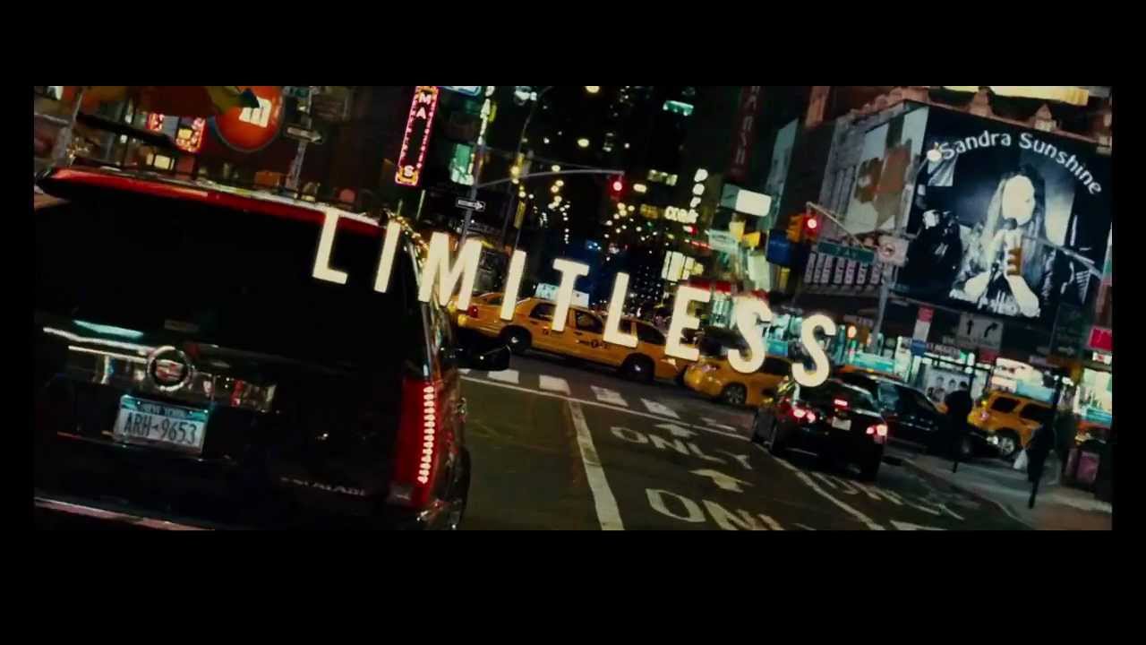
In the movie "Limitless" - 2011, a writer finds the "golden" pill, which allows him to access all of his potentials, giving him fulfilment in life- work and relationships and to accomplish his every goal. The intro of the film, is a very good metaphore of the limitless city. A reflection of todays fluxuating society and the rush to adjust to something that looks as if "it" has begun and as if "it" has no ending.

1st prize of boarderless competition  Hélène Grialou & Sebastien Gafari
In another film by K. Giannaris, "From the Edge of the City" , the undefined city boundaries represent a more vague image of the people who live in the edge of social acceptable. In today's society, to be able to learn quick and easy so as to be as efficient as possible is part of this new world and this tends to be a dominant idea of the new urban utopia. Are we giving our cities some technological shots in the end? Are the boarders going to be defined by what is unable to adjust; inhabited by the marginalized of those without smart-phones?

And so, inspired by the brilliant intro of "Limitless" - here is a google maps version for the city of London. Of course not as well executed, but an animation using Google maps and some free sounds from http://soundbible.com, turned out to be something very quick and easy to do.